WALKS
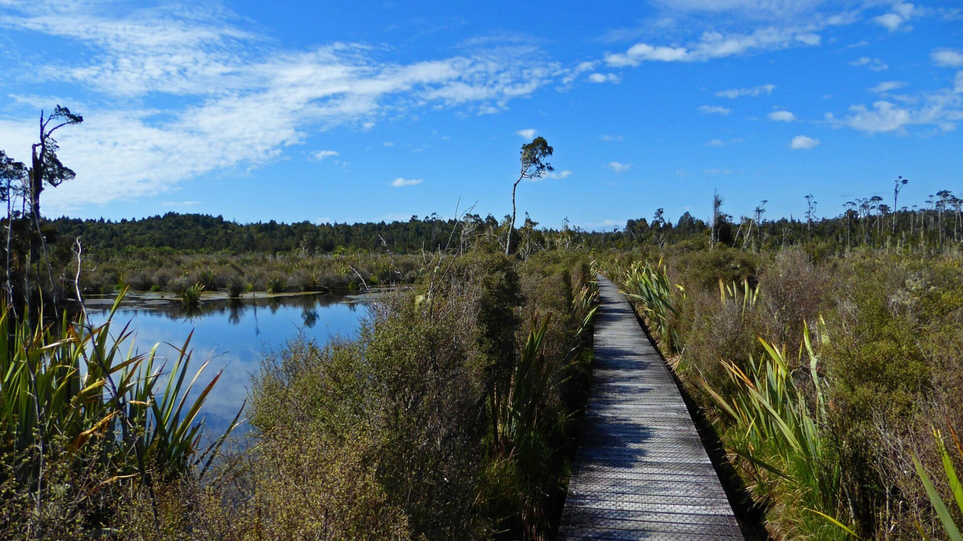
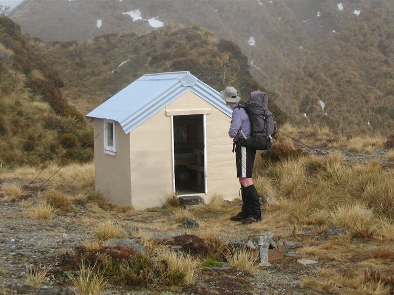
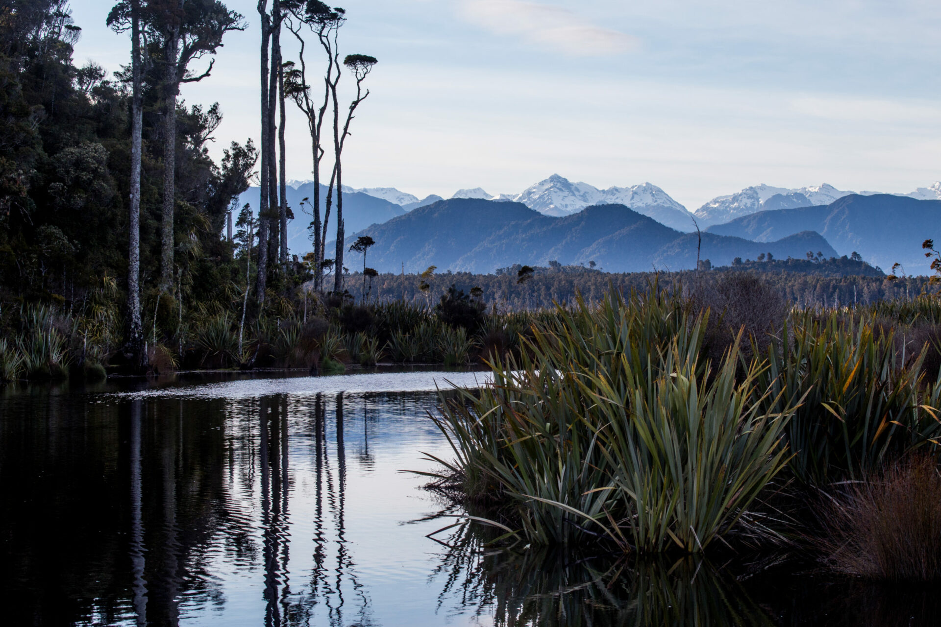
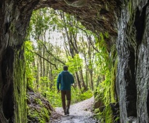
Walking, strolling, hiking, tramping, backpacking. Whatever you call it, there is something to suit your feet within a few minutes of Hokitika. Some say we offer the best range of hikes and rainforest walks in the country.
Filters
LOCATION : Awatuna/Goldsborough
MODERATE
Time: 1.5 hour loop
Access: Starts at Goldsborough camping area, crosses creek and climbs via German Gully Track to Scandinavian Hill Road. Turn north here and return by Goffs Track and part of the Goldsborough Track.
Features: Historic goldmining features in regrowth native forest.
LOCATION : Lake Kaniere
HARD MULTI-DAY
Time: 3-4days one way to Whitcombe Pass
Access: Access from Hokitika is via the Kaniere/Kowhitirangi Road travelling toward the Hokitika Gorge some 30 km inland from Hokitika. After leaving the sealed road, cross two concrete bridges (Diedrich and Granite Creeks). A side road to the left some 100 metres past the second bridge leads to the Whitcombe road end. This side road is signposted “Access to Whitcombe Valley”. The road is prone to flooding part way along and is sometimes left impassable to vehicles. A gate part way in is sometimes locked. At this point there is good parking for vehicles. Beyond the gate the road is suitable for 4WD vehicles only.
Features: This is a classic Trans Alpine trail. The Whitcombe Pass Track takes you through the very rugged bush clad valleys of the lower Hokitika and Whitcombe Rivers to the Main Divide for stunning views. Image: Brian Dobble
See DoC for up to date track and weather information.
LOCATION: Awatuna / Golsborough
EASY
Time: 20 minute loop
Access: Signposted on Stafford-Goldsborough roadside with carpark.
Features: Track enters and exits through old goldmining tailrace tunnels and meanders through old gold workings. Passes through regenerating rimu, kamahi and tree fern forest. A great place to see glowworms at night.
LOCATION: Hokitika Town
EASY Buggies/Strollers ok
Time: 1-2 hours
Access: From i-Site or any point along the walk.
Features: A great way to see the town centre and learn about Hokitikas history and culture. This self-guided walk features Take-a-Seat artseats, public art displays and historical monuments and buildings. Get a town map showing the whole walk and a Heritage Trail brochure which provides information about the historical points of interest. Both available from the Visitor i-Site.
LOCATION: Hokitika Town
EASY Buggies/Strollers ok
Time: 30 min for quayside and central town features, longer if you want to see the whole thing.
Access: From i-Site and Museum, or any point along the walk.
Features: Goldrush and river-port town historic heritage sites, buildings and statues. Brochure and information panels bring history to life. Many sites included on the Town Centre Points of Interest Loop. Request a brochure showing the whole walk from the Visitor i-Site.
LOCATION : Kumara
EASY
Time: 10 min one way
Access: Turn off SH73, 1 km east of Kumara onto a metalled road running alongside a water race
Features: Walk passes through stone-fields of old goldmining tailings & manuka forest to huge glacier-deposited boulder, too big for the early miners to move or break.
LOCATION: Lake Kaniere
EASY/MODERATE
Time: (Walk) 3-4 hours return or 1 hour return (option)
Access: Carpark at the landing at the Northern end of Lake Kaniere. Ends at Kennedy Creek near the Kaniere Forks Power Station. A shorter, easier section from the landing to Wards Road (1 hour return) is most popular.
Features: This track follows an historic, but still used, Kaniere Forks power station water race, through virgin and regrowth forest. Freshwater mussels, cray and the odd trout may be spotted. Open to mountain biking.

